Wainoni Road crossing for the City to Sea Pathway
May 7, 2026
The City to Sea Pathway runs through the heart of the Ōtākaro Avon River Corridor (ŌARC). The 11-kilometre-long, shared-use, all-weather path will largely follow the course of the Ōtākaro Avon River from Oxford Terrace in the central city to Pages Road in New Brighton.
We're currently working on the third section, which runs from the SH74 underpass to the newly formed Waitaki Stop Bank. As we work on the Pathway, we consider any necessary improvements so that it is safe for everyone to use.
We're proposing a new crossing for Wainoni Road to make it safer and easier to use the Pathway.
The City to Sea Pathway runs through the heart of the Ōtākaro Avon River Corridor (ŌARC). The 11-kilometre-long, shared-use, all-weather path will largely follow the course of the Ōtākaro Avon River from Oxford Terrace in the central city to Pages Road in New Brighton.
It is part of the ŌARC Regeneration Plan, with minor route deviations from the Regeneration Plan, and has been funded by central government through the Christchurch Regeneration Acceleration Facility (CRAF).
We’ve been working with mana whenua and key interest groups to finalise the route and inform the design.
City to Sea West which runs between Fitzgerald Avenue to Avon Park is complete and the Eastern section, which runs from Avon Park to State Highway 74 (SH74) underpass, is currently in construction. Consultation for these took place in 2024 and 2025 respectively. To view the previous consultations, click here.
We expect the City to Sea Pathway to become a popular walking and cycling path, with many people using it for recreation, day-to-day travel and commuting. It includes new road crossings to make it way safer for everyone, and new small car parks for access.
No one expects a crash, but people make mistakes, including those who are careful and responsible drivers, and these mistakes shouldn't cost anyone their lives. This means, at road crossing points, we need to slow traffic down, as lower speeds improve survival rates, reduce serious harm to everyone and make people feel safer using the crossing.
We've heard from the community that they currently feel unsafe when crossing some of the roads, due to poor visibility and no dedicated crossing points.
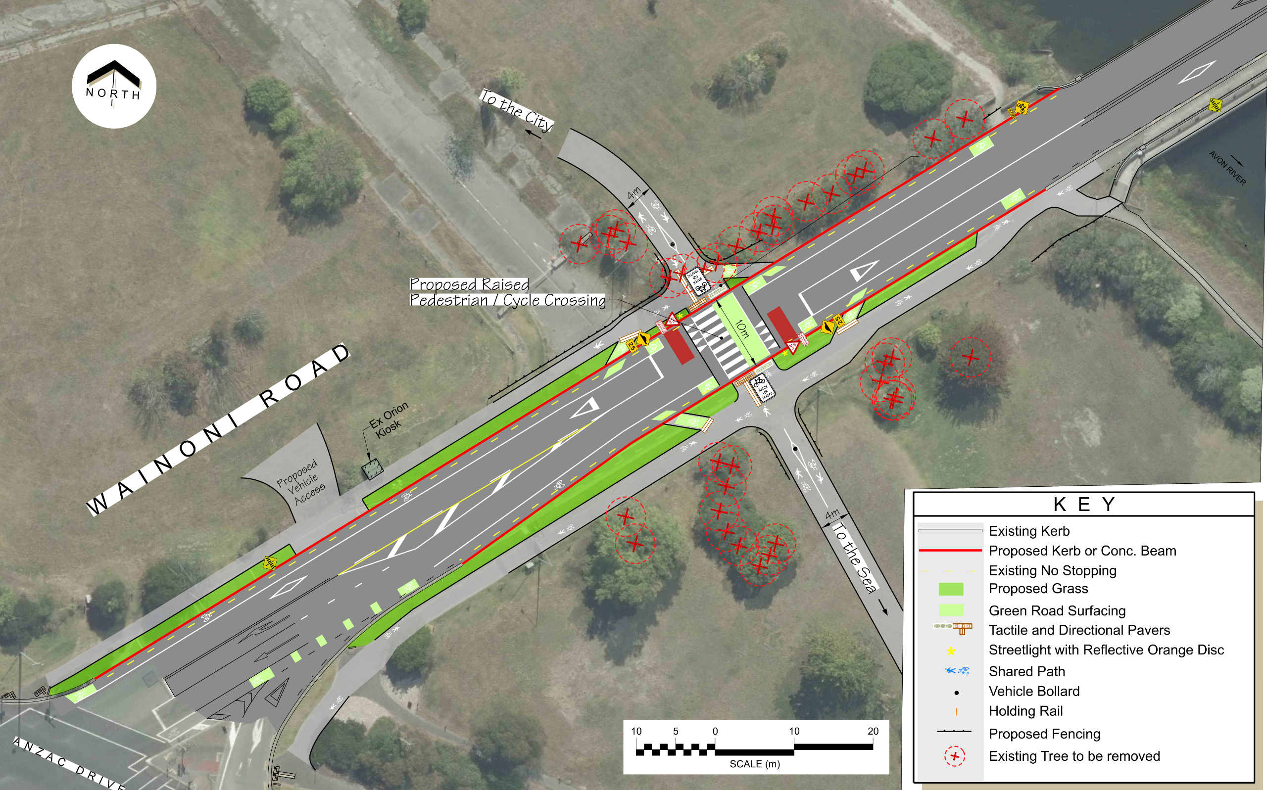
What we're planning
The third section runs from SH74 underpass to the newly formed Waitaki Stop Bank which includes Wainoni Road.
We’re planning a new raised priority crossing on Wainoni Road to make the City to Sea walking and cycling path way safer.
The crossing will require the removal of some trees to ensure cyclists, walkers or joggers are visible as they approach the crossing. Council's policy is to replant two trees for every one we remove. These will be planted as close as possible to the trees removed.
We are also proposing the removal of bus stop #18448. Environment Canterbury have indicated they do not have concerns with the bus stop being removed as it is located away from key population areas and is well covered by the adjacent stops.
As part of these works, we will need to raise this section of Wainoni Road up to 1.5 metres higher than the current level. The level increase is required to align with new stopbanks that will protect the area behind from future river flooding. The City to Sea pathway will be constructed on the top of the new stopbanks.
Have a look at the plans
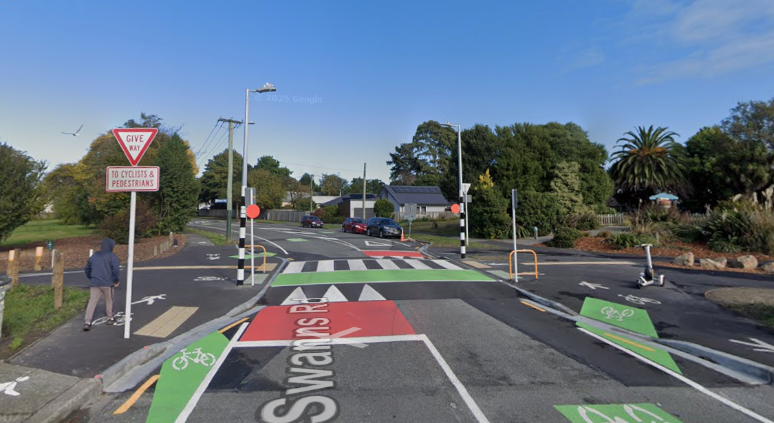
Swanns Road crossing has a similar configuration as is proposed for Wainoni Road.


